To help celebrate New York City’s Open Data Week, Asher Lipman and Adrienne Schmoeker from Helpful Places led two walking tours through Downtown Brooklyn’s business improvement district corridor and the historic neighbourhood of the East Village in Manhattan. In partnership with local technology companies inCitu and Numina, as well as community leaders such as Sarah Batchu and Laura Sewell, and engagement from the Data Through Design exhibitors, Helpful Places used these tours to focus on the often invisible technologies and data that monitor, enable, and support our public spaces. The goal wasn’t to create attractions out of these technologies, or to provide a detailed history of their use. Rather, we used these tours as a way to help show New Yorkers a new way to view their public spaces and surface questions that might otherwise go unasked.

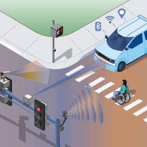
On our tours we pointed out the existence of, and discussed, the following technologies and NYC open datasets:


One clear message that we heard from residents is that understandingthe purpose for the technology matters. When encountering technologies that are designed to blend into our streetscapes, such as security cameras or pedestrian counters, residents quickly focus on figuring out the device’s capabilities.
“Can they get my internet history from that?” one resident said, pointing at a LinkNYC kiosk. “How long is that restaurant keeping this footage?” another asked about a security camera deployed in the East Village, likely to monitor outdoor seating.
When residents don’t have a way to experience or learn more about a technology’s capabilities themselves, they can quickly begin to hypothesise possibilities and alternative scenarios. “Could that be used for enforcement or policing?” was a frequent question.

By contrast, tour members had different reactions to technologies that they could use directly; engaging with the technology or receiving its ‘services’ seemed to enable the user to ‘skip’ questions about its purpose and delve straight into usability and accessibility questions. One stop on the tour, a Bigbelly smart-composting bin that allowed people to unlock the lid using a mobile app, generated a lot of logistical questions. “How can I download this?” one resident asked. “Can I use it if I don’t have a smartphone?” asked another. Several residents had questions about how the technology related to a broader policy goal. One concerned tour member asked, “Does this mean that I have to drop my compost off here instead of the community garden?” However, none of the participants asked about the bin’s capabilities in the same way they had with remote cameras or sensors, or whether third parties might access any data the compost bin collected.
In interacting with inCitu’s augmented reality platform directly we also witnessed quite a few ‘aha’ moments with tour participants skipping questions about how inCitu worked and the purpose behind their augmented reality capabilities and “seeing” an entire new layer of information about a potential heretofore “invisible” future in Downtown Brooklyn.

Another particularly striking insight emerged about halfway through our first walk. After standing on a street corner discussing a security camera we’d noticed, we asked tour members “How many of you still have questions about this sensor?” About three quarters of the group raised their hand. Out of curiosity, we then asked, “How many of you think you would have noticed this camera if you were just walking down the street?” All but one hand lowered — most tour attendees would not have seen the camera. Notice, it seemed, was also key for New Yorkers.
"They must have designed that so it blends in,” one participant said while pointing at a LinkNYC 5G tower. “I can’t believe I didn’t see that.”
A mechanism for notice was key for New Yorkers to be able to take stock of these technologies.
Many technologies that exist in the public realm are made to be unobtrusive, and blend into the physical environment. Cameras, signal boosters, and more are often painted a nondescript grey, and often located above people’s line of sight. While there are aesthetic benefits to this, after all many communities don’t want their neighbourhoods looking like a science fair, this discrete design is a barrier to broader understanding of these digital layers to the city, which can make transparency difficult.
“Now that I know something’s there,” one participant exclaimed, pointing at a camera at a construction site, “I have all these other questions.”
Nobody thinks that every sensor in New York City ought to be painted bright orange and made thirty feet tall, but there is a need for interested residents to know when technologies are being used in ways that may impact them, and how they can address any concerns they might have. This may seem straightforward, but currently it is no small task.

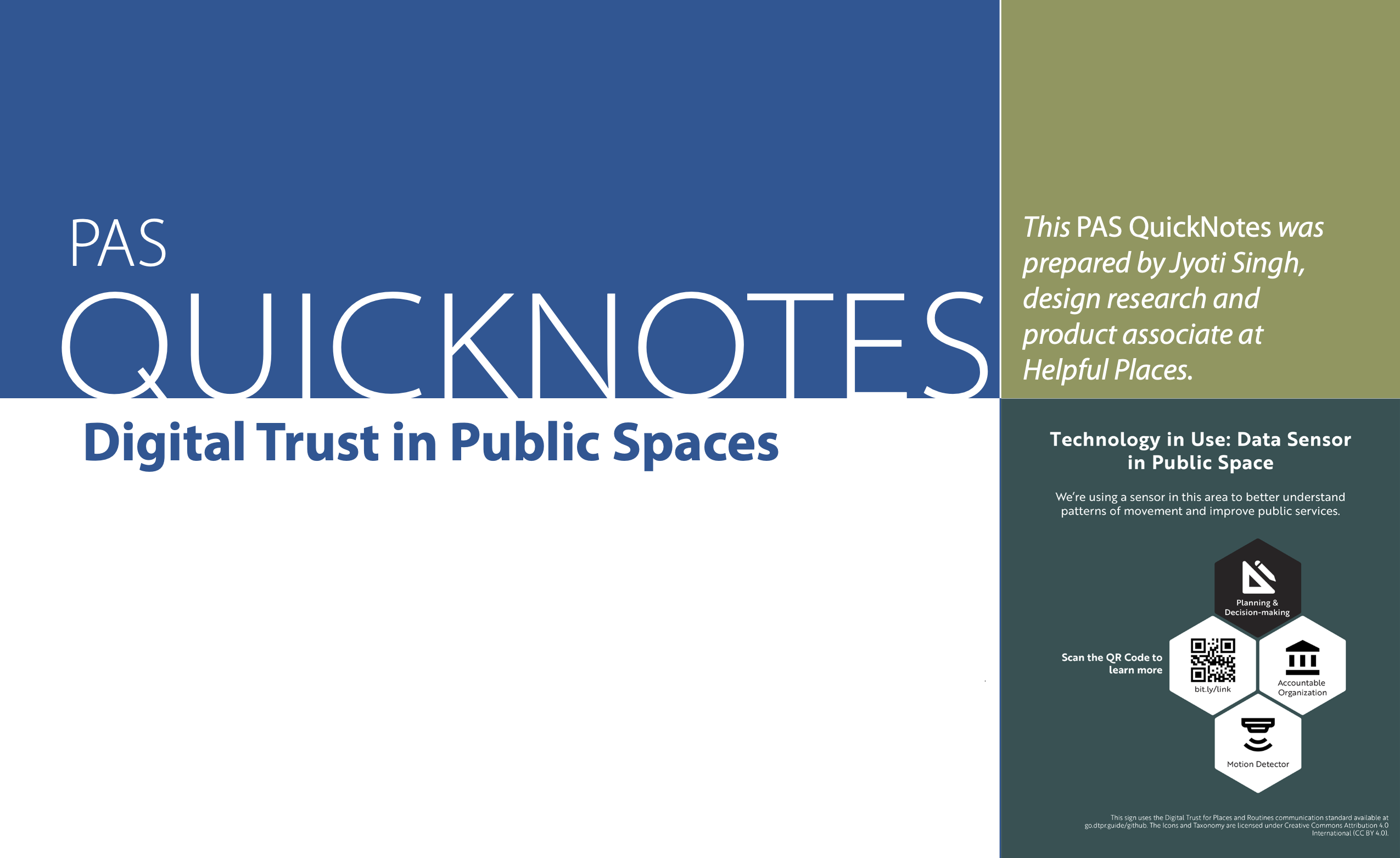
Luckily, finding ways to answer questions like these is getting easier. As part of the tour, we introduced examples of Digital Trust for Places and Routines (DTPR), a standardised visual language and data standard to describe what technologies are in a space and how they work. As we showcased examples of DTPR that other cities have used, residents began to nod their heads.
"It’s like a nutrition label for technology,” we said at the corner of Jay Street and Willoughby. “Sometimes you want the detailed ingredient list, sometimes you just need to know if something has peanuts to prevent an allergic reaction. Either way, you deserve to know.”
Learn more about DTPR and how to get involved at: https://dtpr.io/

To learn more about sensors and technologies in the public realm in NYC we encourage all readers to explore NYC’s IoT Strategy, published in March 2021. For more information about NYC Open Data visit: https://www.nyc.gov/opendata. You can also learn more about technology in NYC via the NYC Office of Technology and Innovation’s website.
We’d like to thank all of our partners and those who advised us in the design and implementation of these walking tours in NYC as a part of NYC’s Open Data Week: